Image shows the desktop interface for the new OpenET FARMS interface.

FARMing with Data: OpenET Launches New Tool for Farmers and Ranchers

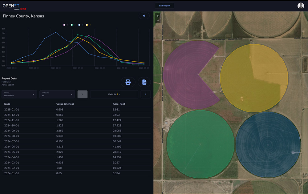
A NASA, DRI, and U.S. Geological Survey (USGS)-supported research and development team is making it easier for farmers and ranchers to manage their water resources. The team, called OpenET, created the Farm and Ranch Management Support (FARMS) tool, which puts timely, high-resolution water data directly in the hands of individuals and small farm operators.

Map showing OpenET data explorer field view.

A New, Rigorous Assessment of OpenET Accuracy for Supporting Satellite-Based Water Management 

A new study offers a comprehensive multi-model, large-scale accuracy assessment of an operational satellite-based data system to compute evapotranspiration. The researchers found that OpenET data has high accuracy for assessing evapotranspiration in agricultural settings, particularly for annual crops like wheat, corn, soy, and rice.